No. 592 JULY 2020 Edited by Mary Rawitzer
Reminder: Our Annual General Meeting could not take place in June due, of course, to the corona virus situation and we still do not know when it will be possible to arrange another date. Meanwhile, the committee remains in place. There will also be no Tuesday lectures until further notice. However, the monthly Newsletters should continue as usual, as well as Jim Nelhams’s regular informative, enjoyable and sometimes mind-stretching updates. These separate news sheets are only being emailed. If you are not getting a copy, please email Jim, address on back page.
Curing the Plague Peter Pickering
Our Prime Minister is known to be keen on Latin. I wonder if he is modelling himself on the emperor Titus (one of the few who have had a good press). Faced with a plague Titus, according to his biographer Suetonius, “did not refrain from any means, human or divine, for restoring health and alleviating sickness, trying every medicine and every kind of sacrifice.”
Whether he was successful or not in these efforts is not recorded.
Council for British Archaeology Sue Willetts
The annual Council of British Archaeology festival normally takes place in July and this year there will be digital events from 11-19 July and, if it proves possible, a further week of events on the ground from 24 October to 1 November 2020. The theme is Climate and Environment.
Events posted so far include: Two online tours of Roman London (11th July and 15th July); Archaeology from home with Emma Cunliffe using space technology (13th July); The campaigns of Septimius Severus in the far north of Britain (14th July). Their website is https://festival.archaeologyuk.org
Other Societies’ and Institutions’ Events
This section is temporarily cancelled due to the coronavirus outbreak. However overleaf is the announcement from Don Cooper of HADAS’s very own offering: the next Finds in Focus course, run by Jacqui Pearce.
1
The Next Finds in Focus Course Don Cooper
Hendon & District Archaeological Society Finds Group
Course Tutor: Jacqui Pearce BA FSA MCIfA
A 22-week course in post-excavation analysis to be held at Avenue House, 17 East End Road, Finchley N3 3QE on Wednesday evenings, 6.30–8.30, starting on 7th October 2020
This year we will be focusing on recording the finds from an excavation carried out by Birkbeck College in 2001 that has not been published. We are aiming to identify, record, rebag and re-label all the finds including Pottery, Glass and Clay Pipe to Museum of London standards. Regular presentations and professional tuition will be provided throughout the course. This is an ideal opportunity to gain – or increase – your experience of working with and handling a wide variety of archaeological finds. Teaching sessions on the various types of finds will be complemented by practical handling and recording sessions. Our aims are to introduce the various types of finds and provide hands-on opportunities to become more familiar with post-excavation procedures.
All are welcome – it doesn’t matter whether or not you have experience of working with archaeological finds!
Course fee: £295 for 22 sessions. To book, contact Don Cooper (olddormouse@hotmail.com; tel. 020 8440 4350) or Jacqui Pearce (pearcejacqui@gmail.com; tel. 020 8203 4506). Please make cheques payable to HADAS and send to Don Cooper, 59 Potters Road, Barnet, EN5 5HS.
2
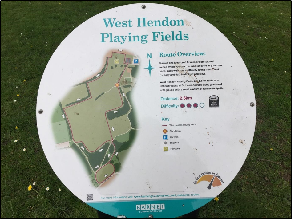
ON THE FRINGE – WEST HENDON PLAYING FIELDS Andy Simpson
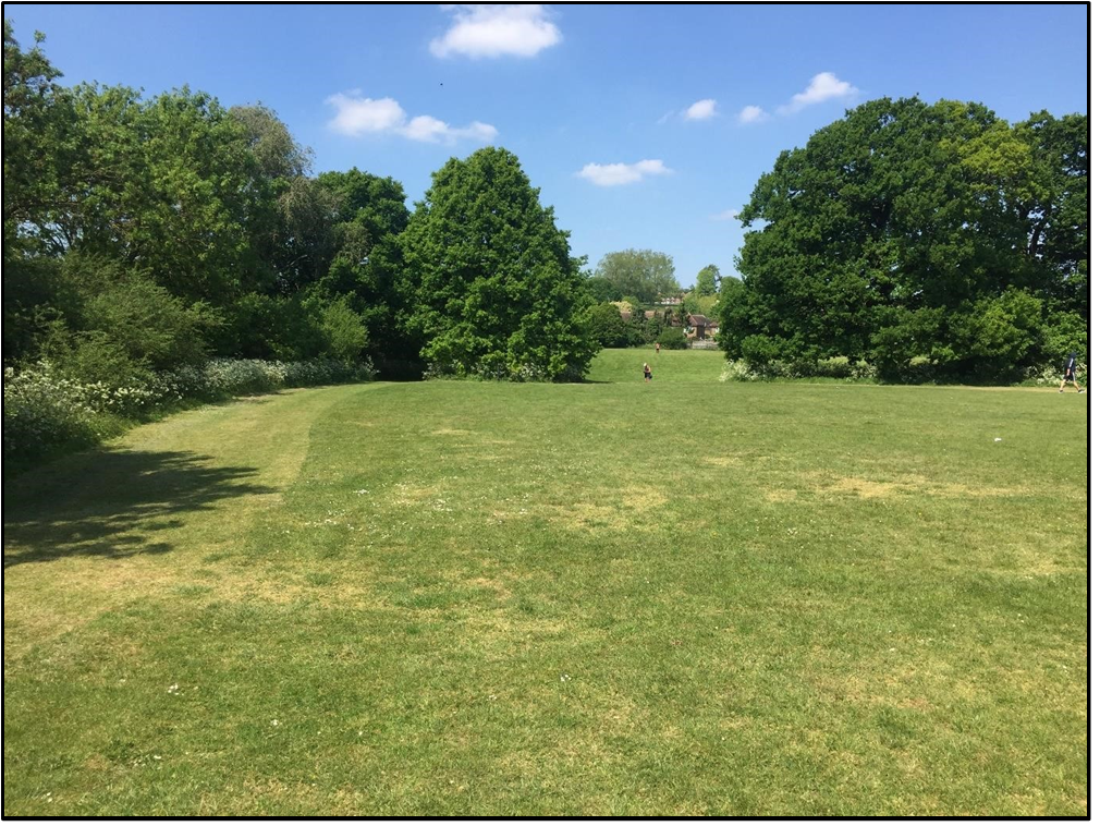
Under the current coronavirus restrictions, I have since April 2020 taken a number of my permitted exercise walks around West Hendon Playing Fields, shown in Figure 1, a convenient 10-minute walk from my flat.
These very pleasant 62-acre playing fields are just within Barnet Borough. Directly adjacent is the Silver Jubilee Park,which houses Hendon FC at its southern end. This is in Kingsbury which is part of Brent. Both appear to have a significant history which may well be worth investigating further, particularly as the playing fields are due for updating, and some ground works under a new Barnet Council scheme were approved early in 2020 following public consultation.
The Borough boundary between Barnet and Brent isalso a long-standing field boundary, marked by the substantial north-south hedge line that divides the playing fields from the park. As summarised below, the site does have some history. To the south it includes Cool Oak Lane, referred to as Cold Duck Lane on some early maps, which divides the playing fields from the main area of the Welsh Harp (Brent) Reservoir. The reservoir was originally just a feeder from the River Brent at Kingsbury dug in 1809/10 when the Grand Junction Canal Co. needed water for their canal at Lower Place, Willesden.
3
In 1833 the Regent’s Canal Company decided to build the reservoir to supply the Paddington Canal at Harlesden, which opened in 1838. They did this by building a dam at Kingsbury to form the reservoir in 1835-39 using the existing feeder.
Before this the area had been grazing land either side of the Silk Stream and the River Brent. The Silver Jubilee Park is now bordered on the south by the Brent Reservoir nature reserve. For a full history and description, see http://www.londongardensonline.org.uk/gardens–online–record.php?ID=BRE039
Late Bronze Age ‘cinerary urns of the Ashford type’ were found on the Kingsbury side of the Welsh Harp/Brent Reservoir around 1930 at grid reference NGR TQ218872 and, during lowering of the water level and strengthening of the banks of the reservoir in 1974, members of the Wembley Historical Society found a copper as of Constantius II who reigned from AD337-361. (The as is a coin worth a quarter sestertius).
The playing fields and the neighbouring Silver Jubilee Park run roughly parallel with the Edgware Road, bounded in the north by the east-west Kingsbury Road, close to where it joins the Edgware Road in Colindale. It is here that our friends the Romans enter the scene – much of the western border of Hendon being, since the time of the Medieval Parish of Hendon, formed by the line of the Roman Road from London to Verulamium and the Midlands, later named Watling Street in Saxon times and today called the Edgware Road, except in the area of West Hendon with part of the Welsh Harp and the Cool Oak area where there is a pronounced ‘bulge’ to the west away from the line of the road.
Sherds of Roman pottery were apparently found at the site of the former Hendon Isolation Hospital in Goldsmith Avenue, south of the Kingsbury Road, which is close to the Edgware Road and runs down towards Fryent Fields and the north end of the West Hendon Playing Fields – at grid reference TQ 213884; HER ref 081917. They were actually reported by Ian Robertson of the Passmore Edwards Museum and a HADAS member who directed the HADAS excavation at Church Farm.
The former isolation hospital, latterly a geriatric hospital by 1970, was built in 1929 , expanded by 1940, but demolished in 1984 and replaced by housing; see http://www.ezitis.myzen.co.uk/hendonisolation.html
In Domesday book the whole Parish of Hendon was in the Hundred of Gore, held by Westminster Abbey, the boundaries seemingly largely fixed by the late 10th century. Hugh Petrie, in Hendon & Golders Green Past, and the Victoria County History (VCH) volume on Middlesex record that from 1442 All Souls College, Oxford, owned considerable amounts of land in Hendon, Edgware and Kingsbury, in scattered parcels giving a total of 224acres.
West Hendon Playing Fields were originally part of an estate given to the Knights Templar in 1243, passing to St Pauls Cathedral in 1544, the 110 acre estate being leased to the Duke of Chandos and his descendants in the 18th Century. In 1872 it was vested in the Ecclesiastical Commissioners and most of it was sold to Hendon U.D.C in 1919 for use as the West Hendon Playing Fields and park.
On the 1896 one-inch OS Map the general area south of Kingsbury Road is marked as Townsend; today the western edge of the Silver Jubilee playing fields is bounded by Townsend Lane. Open country still stretched south from West Hendon to Cricklewood railway sidings in 1914, while the badly drained ground on the Kingsbury border never attracted housing. Latterly known as Reets Farm, producing hay for the London market by 1894, the playing fields area became Kingsbury Lane Playing Fields after the sale to Hendon Council in 1919. Since 1924 it has been called West Hendon Playing Fields. As noted in the Middlesex VCH, in 1932 Hendon Borough Council owned 793½ acres of open spaces in Hendon and Edgware including Moat Mount open space (67 a.), Arrandene Park (57 a.),
4
Watling Park (46 a.), Montrose Playing Fields (30 a.), Copthall Park (146 a.), West Hendon Playing Fields (62 a.), Woodfield Park (40 a.) and Clitterhouse Playing Fields (50 a.).
Shown on the 1873 6-inch Ordnance Survey map under its earlier name of Rise Farm, https://maps.nls.uk/view/102345949 Reets farm is shown on the 6-inch OS map for 1897 https://maps.nls.uk/view/101454874 sitting just below the sloping 200ft contour line. By 1935-6 when the map was revised on the eve of sale of the land to Wembley U.D.C as Silver Jubilee Park, it had been demolished and the site cleared.
The Reets Farmhouse and outbuildings still survived amongst trees in 1929, with post-1912 allotment gardens between it and the Kingsbury Road in the area near the top of what is now the Silver Jubilee Park playing fields, and its former farmland area was occupied by the park, West Hendon Playing Fields, a nursery and allotment gardens. See https://www.british–history.ac.uk/vch/middx/vol5/pp11–16
The farm is commemorated by a street name, Reets Farm Close, near Goldsmith Avenue and the junction of Kingsbury Road and Edgware Road.
The allotment gardens, with Reets Farm, its extensive outbuildings to the east of the farmhouse, and the extensive newly built Isolation Hospital can be seen in aerial photographs taken in 1929. see https://britainfromabove.org.uk/cy/image/EPW030078 and https://britainfromabove.org.uk/en/image/EPW029984
For a view of Reets Farm see image at Barnet archives web page.
Today the West Hendon Playing Fields remain a public park with several football pitches forming a large grassed area and with scattered mature trees.
5
There are two quite marked hedge lines – one of them running north-south dividing West Hendon Playing Fields from Silver Jubilee Park and forming the Borough boundary, the other an east-west ditch, bank and tree line at the northern end which may be of some age, dividing the site in two. Both are clearly shown on the Ordnance Survey first edition 6-inch map of 1873 with no other hedge lines at that point crossing what is now the park. The eastern boundary of what is now the playing fields was formed by the Edgware Road on the 1873 map.
Rocque’s 1756 map of Middlesex appears to show the same hedge lines/boundaries; at this time the area was held by St Paul’s Cathedral and All Souls College.
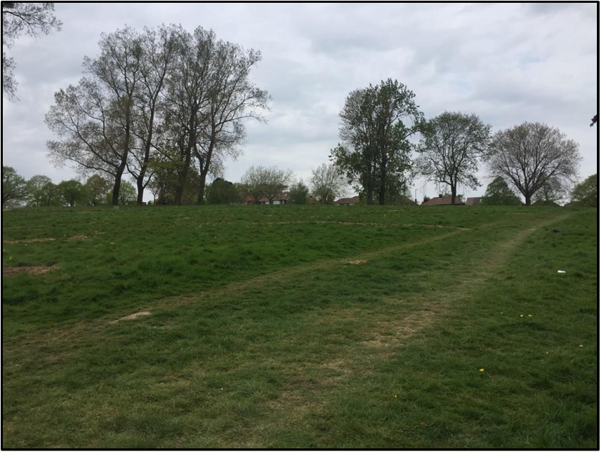
In the West Hendon fields there is a distinct rectangular area at the NW corner, bounded by the above mentioned hedge lines. At the northern end of this field the dry weather of May 2020 revealed a very distinct east-west parch mark showing as a slightly raised bank on the ground. It appears to be a former roadway of unclear date that runs from a northern pedestrian entrance to the park and terminates at the north-south hedge line.
There is a pleasant area of woodland at the southern and eastern edges of the playing fields. There are also two tennis courts, several football pitches, a children’s playground, a private bowls club, and a car park.
6
The Eastern boundary of the playing fields is formed by the northern arm of the Brent Reservoir up to the Edgware Road where it narrows to become the course of the Silk Stream.
The reservoir was enlarged between 1851 and 1853, though part of the northern arm reaching north-east of the Edgware Road was reclaimed when the stream under the road was culverted in 1921.
The area at TQ21487 (Cool Oak Lane) was the site of landfill – recorded in data from the British Geological Survey supplied to the Environment Agency. It is not known whether this site was made or worked land, and the date of the infill is unknown, although all finds were of 19th/20th century date, suggesting it was part of this work. https://edithsstreets.blogspot.com/2012/12/silk–stream–west–hendon.html .
During the London Blitz September 1940-June 1941, the area of the playing fields was hit by at least three high explosive bombs near Fryent Grove and Goldsmith Avenue, and on the western side there is a heavily disturbed area of ground with one or more possible bomb craters still visible on the ground, with at least one more hitting the Silver Jubilee Playing Fields– see http://bombsight.org/explore/greaterlondon/barnet/west–hendon/
Former Royal Air Force Museum colleague Christopher Herbert suggests that the bombs that hit the playing fields were intended for the AA battery located in the adjacent Silver Jubilee Park to defend the nearby LMS railway marshalling yards at Cricklewood.
The first bombs hit the outskirts of the Hendon area on 5 September 1940, with the nearby Hendon airfield and its environs being bombed on 24-25 September and the nights of 7-8 October and 8 November, with sporadic raids on the area until the Spring of 1941.
This latest version of the report includes some changes made after the public consultation with various conservation bodies. It is intended to install two artificial turf pitches at the southern end of the site which may impact on any surviving archaeological features such as earlier field boundaries.
The planned changes to the park can be viewed at:
https://open.barnet.gov.uk/dataset/24596/west-hendon-playing-fields-addendum-report-consultation- report-and-draft-final-master-plan
THE NEXT DOOR NEIGHBOUR
In neighbouring Kingsbury by 1965 there were 262 acres of open space, most of which, having also been part of the medieval Hundred of Gore, had also been acquired from All Souls College, Oxford. The college sold the land forming Silver Jubilee Park (36 acres) to Wembley U.D.C. in 1936 and Fryent open space (160 acres) to Middlesex County Council in 1938. Roe Green Park (20 acres) had been acquired in 1934.
For a description of the hourglass-shaped Silver Jubilee Park see:
http://www.londongardensonline.org.uk/gardens-online-record.php?ID=BRE033 Grid ref TQ209881. It is bounded to the north by the Kingsbury Road, to the west by the hedge line separating it from the West Hendon Playing Fields, and to the East by Townsend Lane, which, as with the northern part of the park, rises steeply towards its junction with the Kingsbury Road, the boundary here being a modern hedge line.
7
Rather more recent is the site of the Second World War heavy anti-aircraft battery located in the park, recorded in the 1990s CBA Defence of Britain survey; heavy anti-aircraft battery ZW14 at Silver Jubilee Park, West Hendon, was listed as armed in 1940-2. It was manned by 370 Battery of the 117th Royal Artillery Regiment in 1943. In 1946 it was retained as a Nucleus Force Headquarters Battery.
The earliest date upon which the site is listed as present within the sources is Feb 1940 and the latest 15 Jan 1946. The site was unarmed/manning vacant in 1940; Regiment 71, Battery 325 on 30 July 1942; Regiment 137 (mixed), Battery 476 on 9 Dec 1943. NGR ref TQ211881.
❖❖❖❖❖❖❖❖❖❖❖❖❖❖❖❖❖❖❖❖❖❖❖❖❖❖❖❖❖❖❖❖❖❖❖❖❖❖❖❖❖❖❖❖❖❖
With many thanks to this month’s contributors:
Don Cooper, Peter Pickering, Andy Simpson and Sue Willetts
Hendon and District Archaeological Society
Chairman Don Cooper 59, Potters Road, Barnet, Herts EN5 5HS
(020 8440 4350) e-mail: chairman@hadas.org.uk
Hon. Secretary Jo Nelhams 61, Potters Road, Barnet, Herts EN5 5HS
(020 8449 7076) e-mail: secretary@hadas.org.uk
Hon. Treasurer Roger Chapman 50, Summerlee Ave, London N2 9QP
(07855 304488) e-mail: treasurer@hadas.org.uk
Membership Sec. Stephen Brunning Flat 22, Goodwin Court, 52 Church Hill Road,
East Barnet, EN4 8FH
(020 8440 8421) e-mail: membership@hadas.org.uk
Web site:https://www.hadas.org.uk/
❖❖❖❖❖❖❖❖❖❖❖❖❖❖❖❖❖❖❖❖❖❖❖❖❖❖❖❖❖❖❖❖❖❖❖❖❖❖❖❖❖❖❖
8